Geography - geography.
Publié le 26/05/2013
Extrait du document
«
A Collecting Data
Geographers may collect data in the field or from secondary sources, such as censuses, statistical surveys, maps, and photographs.
Advances made since World War II(1939-1945) in the use of aerial photography, including the use of special films, and in techniques for obtaining three-dimensional views of the landscape from the air haveenabled geographers to perform more detailed studies of the earth and its resources ( see Aerial Survey).
Geographers also have made use of radar, artificial satellites, underwater crafts called bathyspheres, and deep drilling into the earth's crust to obtain information about the features of the earth.
B Mapping
The map is the most important tool of geography and may be used to record either simple data or the results of a complicated geographic study.
In addition to providing awealth of factual information, the map permits visual comparison between areas because it may be designed to indicate, by means of symbols, not only the location but alsothe characteristics of geographic features of an area.
Geographers have developed a standard pattern of map symbols for identifying such cultural features as homes, factories, and churches; dams, bridges, and tunnels;railways, highways, and travel routes; and mines, farms, and grazing lands.
C Analyzing Geographic Information
Techniques that use mathematics or statistics to analyze data are known as quantitative methods.
The use of quantitative methods enables geographers to treat a largeamount of data and a large number of variables in an objective manner.
Frequently, geographers collect data and form a theory to explain their observation.
They then testthis theory using quantitative methods.
Sometimes the theories are expressed as mathematical statements, called models.
Nevertheless, in geography theories are notexpected to be universally precise, but rather to explain an observed tendency.
IV HISTORY OF GEOGRAPHY
Hundreds of individuals have contributed to the development of geography, and the fruits of their work have accumulated over several thousand years.
Many travelers,surveyors, explorers, and scientific observers have added to this growing store of information.
Only since the late 1700s, however, has it been possible to collect and recordtruly accurate geographic information.
Modern concepts of geography were not widely supported until the mid-1800s.
A Early Geographers
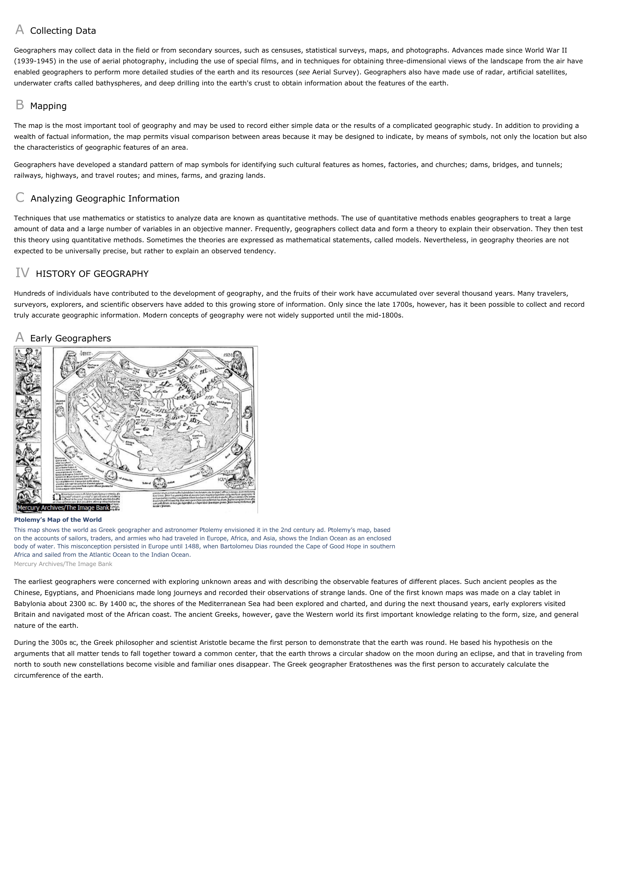
Ptolemy’s Map of the WorldThis map shows the world as Greek geographer and astronomer Ptolemy envisioned it in the 2nd century ad.
Ptolemy’s map, basedon the accounts of sailors, traders, and armies who had traveled in Europe, Africa, and Asia, shows the Indian Ocean as an enclosedbody of water.
This misconception persisted in Europe until 1488, when Bartolomeu Dias rounded the Cape of Good Hope in southernAfrica and sailed from the Atlantic Ocean to the Indian Ocean.Mercury Archives/The Image Bank
The earliest geographers were concerned with exploring unknown areas and with describing the observable features of different places.
Such ancient peoples as theChinese, Egyptians, and Phoenicians made long journeys and recorded their observations of strange lands.
One of the first known maps was made on a clay tablet inBabylonia about 2300 BC.
By 1400 BC, the shores of the Mediterranean Sea had been explored and charted, and during the next thousand years, early explorers visited Britain and navigated most of the African coast.
The ancient Greeks, however, gave the Western world its first important knowledge relating to the form, size, and generalnature of the earth.
During the 300s BC, the Greek philosopher and scientist Aristotle became the first person to demonstrate that the earth was round.
He based his hypothesis on the arguments that all matter tends to fall together toward a common center, that the earth throws a circular shadow on the moon during an eclipse, and that in traveling fromnorth to south new constellations become visible and familiar ones disappear.
The Greek geographer Eratosthenes was the first person to accurately calculate thecircumference of the earth..
»
↓↓↓ APERÇU DU DOCUMENT ↓↓↓
Liens utiles
- Tokyo - geography.
- Toronto - geography.
- Venice (Italy) - geography.
- Vienna - geography.
- Warsaw - geography.


