Sierra Nevada - geography.
Publié le 04/05/2013
Extrait du document

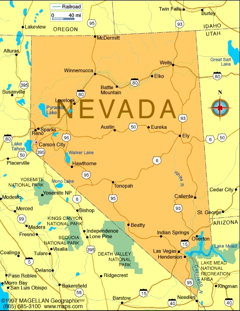
Sierra Nevada - geography. Sierra Nevada, mountain range, western United States. A major range, chiefly in California with a small portion in Nevada near Lake Tahoe, it extends from northwest to southeast for approximately 640 km (approximately 400 mi) and varies in width from 65 to 130 km (from 40 to 80 mi). It is bounded on the north by a gap south of Lassen Peak and by the Cascade Range, and on the south by Tehachapi Pass. The tallest peak in the range is Mount Whitney (4,418 m/14,494 ft above sea level), which is also the tallest peak in the conterminous United States. The western part of the southeastern portion of the range is called the High Sierra. It consists of a region with an elevation between 1,800 and 3,600 m (6,000 and 12,000 ft) above sea level and peaks that reach elevations 600 m (2,000 ft) higher. Mount Whitney is one of the peaks; others include Williamson (4,382 m/14,375 ft), North Palisade (4,341 m/14,242 ft), Russell (4,293 m/14,086 ft), Middle Palisade (4,279 m/ 14,040 ft), Langley (4,276 m/ 14,028 ft), and Tyndall (4,273 m/14,018 ft). The Sierra Nevada is composed, geologically, of one unit, a single block of the earth's crust tilted upward toward the east. Granite, other igneous rocks, and metamorphic slate are the principal rocks of the range. The slopes of the range are covered with great forests. Gold embedded in quartz is found in large quantities, and silver mines have been opened on the eastern side. A number of national forests and parks are situated in the Sierras, including Sequoia, Kings Canyon, and Yosemite national parks and the Sequoia, Tahoe, and Sierra national forests. Microsoft ® Encarta ® 2009. © 1993-2008 Microsoft Corporation. All rights reserved.
Liens utiles
- Sierra Nevada - geography.
- Nevada (sierra).
- Lac Mono (Sierra Nevada, Californie).
- Nevada - geography.
- Sierra Madre (mountain range, Mexico) - geography.


