Devoir de Philosophie

Congo (river) - Geography.

Publié le 03/05/2013

Extrait du document
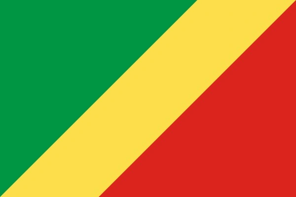
congo
Congo (river) - Geography. I INTRODUCTION Congo (river), river in Central Africa, for which two African countries are named: Democratic Republic of the Congo (DRC, formerly Zaire) and Republic of the Congo. The entire length of the river lies within DRC or forms part of its border. At 4,374 km (2,718 mi) long, the Congo is the second longest river in Africa (after the Nile) and one of the longest in the world. It is also one of the largest rivers in the world in area of its watershed and in volume of water discharged. The Congo drains the vast Congo River Basin, an area of more than 4.1 million sq km (1.6 million sq mi), and, at high water periods, discharges approximately 34,000 cubic meters (1.2 million cubic feet) of water per second into the sea. Located in the heaviest rainfall belt of Africa, the Congo carries more water than any river except the Amazon in South America. As a navigable route into the African interior, the Congo serves as a main artery for transportation and has figured prominently in the region's history. Kinshasa, the capital of DRC, and Brazzaville, the capital of Republic of the Congo, lie across the river from each other in the lower reaches of the Congo. II DESCRIPTION Formed by the junction of the Lualaba and Luvua rivers in southern DRC, the Congo flows generally north as far as Stanley Falls, then loops west and south to an outlet on the South Atlantic Ocean. The river is as wide as 16 km (10 mi) in places and contains more than 4,000 islands. The Congo River Basin includes most of DRC, Republic of the Congo, northern Angola, northern Zambia, western Tanzania, and southern Central African Republic. The region is densely covered with tropical vegetation, particularly in the river valleys. The rich wildlife of the river includes crocodiles and numerous species of fish. The river system is divided into four sections: the headwaters, the Upper Congo, the Middle Congo, and the Lower Congo. A Headwaters The Congo's remotest headstreams rise in northern Zambia and southern DRC, in elevations ranging from 1,000 to 2,000 m (3,000 to 7,000 ft) above sea level. These headstreams are broken by many rapids and therefore cannot be used for commercial navigation. In Zambia, the Chambeshi and other headstreams drain into Lake Bangweulu, a shallow lake surrounded by large swamps. The waters of Lake Bangweulu overflow into the Luapula, which forms the border between Zambia and DRC and flows into Lake Mweru. Lake Mweru drains into the Luvua in DRC. To the west, in southern DRC, the Lualaba and its headstreams rise in the highlands of the Katanga region. The Lualaba is joined by the Lufira at Lake Upemba and flows north to meet the Luvua in northern Katanga, an administrative region of the DRC. B Upper Congo The Upper Congo (sometimes referred to as a continuation of the Lualaba) flows from the junction of the Lualaba and the Luvua northward to Stanley Falls (also called Boyoma Falls). Only 300 km (200 mi) of the Upper Congo, between the towns of Kindu and Ubundu, is navigable. Beyond Ubundu, a chain of seven cataracts makes the river impassable for 100 km (60 mi). Stanley Falls, the last of these cataracts, is 50 km (30 mi) north of the equator and 460 m (1,520 ft) above sea level. Kisangani, one of the largest cities in the DRC, lies just below the falls. C Middle Congo The Middle Congo curves to the northwest, west, and southwest, descending only about 100 m (about 300 ft) between Stanley Falls and Pool Malebo. This entire stretch--more than 1,600 km (1,000 mi)--is navigable. It receives the four greatest tributaries of the Congo: the Lomami, Aruwimi, Ubangi, and Kasai rivers. The Lomami, flowing northward roughly parallel to the Upper Congo, enters from the south 130 km (80 mi) downstream from Kisangani. The Aruwimi, known in its upper reaches as the Ituri, drains an area of great forests west of Lake Albert. It flows westward and enters the Congo from the north 100 km (60 mi) below the mouth of the Lomami. The Ubangi, the largest of the Congo's tributaries, flows from the confluence of the Mbomou and Uélé rivers west along the border between DRC and the Central African Republic. Near Bangui, capital of the Central African Republic, the Ubangi turns sharply to the south, entering the Congo just south of the equator. From this confluence to a point below the city of Kinshasa the Middle Congo forms the border between DRC and Republic of the Congo. Midway along this section, the Kasai (known in its lower reaches as the Kwa) flows into the Congo from the east. The Kasai and its tributaries flow generally northwest from northern Angola into DRC. Other major tributaries on the Middle Congo include the Lulonga, Ikelemba, Ruki, Itimbiri, Mongala, and Sangha rivers. Mbandaka, located above the mouth of the Ubangi, is the main town of the Middle Congo. About 160 km (about 100 mi) below the mouth of the Kwa, the Congo widens into a lake, known as Pool Malebo, and flows around Mbamou Island. As the Congo narrows again, the capitals of DRC and Republic of the Congo face each other from opposite banks of the river--Kinshasa, DRC, on the south bank and Brazzaville, Republic of the Congo, on the north. D Lower Congo The Lower Congo, from Pool Malebo to the Atlantic Ocean, is 435 km (270 mi) long. Wild rapids make most of the stretch unnavigable to all but small river craft. The last of the rapids occurs 153 km (95 mi) from the sea. The major port of Matadi is located on the south bank just below these rapids. A railroad connects Kinshasa and Matadi. Below Matadi, the Congo forms the border between DRC and Angola before emptying into the Atlantic Ocean. III ECONOMIC IMPORTANCE The Congo and its tributaries provide 14,500 km (9,000 mi) of navigable waterways, a vital means of transportation to millions of people in Central Africa. Traders ship goods from the interior downstream to Kinshasa, where they are loaded onto trains to bypass the rapids of the Lower Congo. At Matadi, the goods are loaded onto larger ships for transportation down the river and into the Atlantic Ocean. Chief modes of river transportation are steamboats and long canoes, known as pirogues. Fish caught in the river include perch, tilapia, and eels, most of which are consumed locally. Although little development has taken place, the hydroelectric power of the Congo River Basin is enormous. IV HISTORY Bantu-speaking people have lived along the Congo for at least 2,000 years, supporting themselves with fish from the river and farms on the fertile lands between the river and forest. A powerful kingdom of the Kongo people, centered at the mouth of the river, emerged by the 1300s. Portuguese navigator Diogo Cam, the first European known to visit the river, entered the Congo estuary on a voyage from 1482 to 1484. He claimed the surrounding region as Portuguese territory, leaving a marble shaft on the riverbank as proof of his discovery. To Europeans the river became known as the Rio de Padrão (Pillar River). The Kongo king welcomed Cam and subsequent Portuguese explorers and established friendly trading relations with the Portuguese. More than 300 years elapsed before serious exploration of the Congo was undertaken. Francisco José de Lacerda, a Portuguese explorer, reached the copper-rich Katanga region from the east in 1798, as did Arab traders in the first half of the 1800s. The Arabs extended their influence over the eastern Congo River Basin, engaging in the slave and ivory trades. Scottish explorer and missionary David Livingstone visited the Luapula and Lualaba rivers in 1871, believing them to be sources of the Nile. The first explorer to investigate the Congo itself was Anglo-American explorer and journalist Henry Morton Stanley. In 1876 and 1877 Stanley descended the length of the Lualaba-Congo river system to its mouth, traveling more than 2,600 km (1,600 mi). Under the employment of Belgian king Leopold II, Stanley returned to the Congo from 1879 to 1884. He established 22 settlements on the Congo and its tributaries, put four steamers into operation on the upper river, and built a road around the Lower Congo rapids between Matadi and Pool Malebo. In 1885 the Congo Free State, which included most of the Congo River Basin, was founded as the personal property of Leopold II. In 1908 the entity became a colony of Belgium, known as the Belgian Congo, and in 1960 it achieved independence as the Congo. In 1971 the government of Mobutu Sese Seko changed the names of both the country and the river to Zaire, after an old, supposedly more authentic local name for the river. When Mobutu was overthrown in 1997, the country became Democratic Republic of the Congo, and the river's name was changed back to the Congo. Microsoft ® Encarta ® 2009. © 1993-2008 Microsoft Corporation. All rights reserved.
congo

« region as Portuguese territory, leaving a marble shaft on the riverbank as proof of his discovery.

To Europeans the river became known as the Rio de Padrão (Pillar River).

The Kongo king welcomed Cam and subsequent Portuguese explorers and established friendly trading relations with the Portuguese.

More than 300 yearselapsed before serious exploration of the Congo was undertaken. Francisco José de Lacerda, a Portuguese explorer, reached the copper-rich Katanga region from the east in 1798, as did Arab traders in the first half of the 1800s.

TheArabs extended their influence over the eastern Congo River Basin, engaging in the slave and ivory trades.

Scottish explorer and missionary David Livingstone visitedthe Luapula and Lualaba rivers in 1871, believing them to be sources of the Nile.

The first explorer to investigate the Congo itself was Anglo-American explorer andjournalist Henry Morton Stanley.

In 1876 and 1877 Stanley descended the length of the Lualaba-Congo river system to its mouth, traveling more than 2,600 km (1,600mi). Under the employment of Belgian king Leopold II, Stanley returned to the Congo from 1879 to 1884.

He established 22 settlements on the Congo and its tributaries,put four steamers into operation on the upper river, and built a road around the Lower Congo rapids between Matadi and Pool Malebo.

In 1885 the Congo Free State,which included most of the Congo River Basin, was founded as the personal property of Leopold II.

In 1908 the entity became a colony of Belgium, known as theBelgian Congo, and in 1960 it achieved independence as the Congo.

In 1971 the government of Mobutu Sese Seko changed the names of both the country and theriver to Zaire, after an old, supposedly more authentic local name for the river.

When Mobutu was overthrown in 1997, the country became Democratic Republic of theCongo, and the river’s name was changed back to the Congo. Microsoft ® Encarta ® 2009. © 1993-2008 Microsoft Corporation.

All rights reserved.. »

↓↓↓ APERÇU DU DOCUMENT ↓↓↓

Liens utiles