Bangkok - geography.
Publié le 27/05/2013

Extrait du document
«
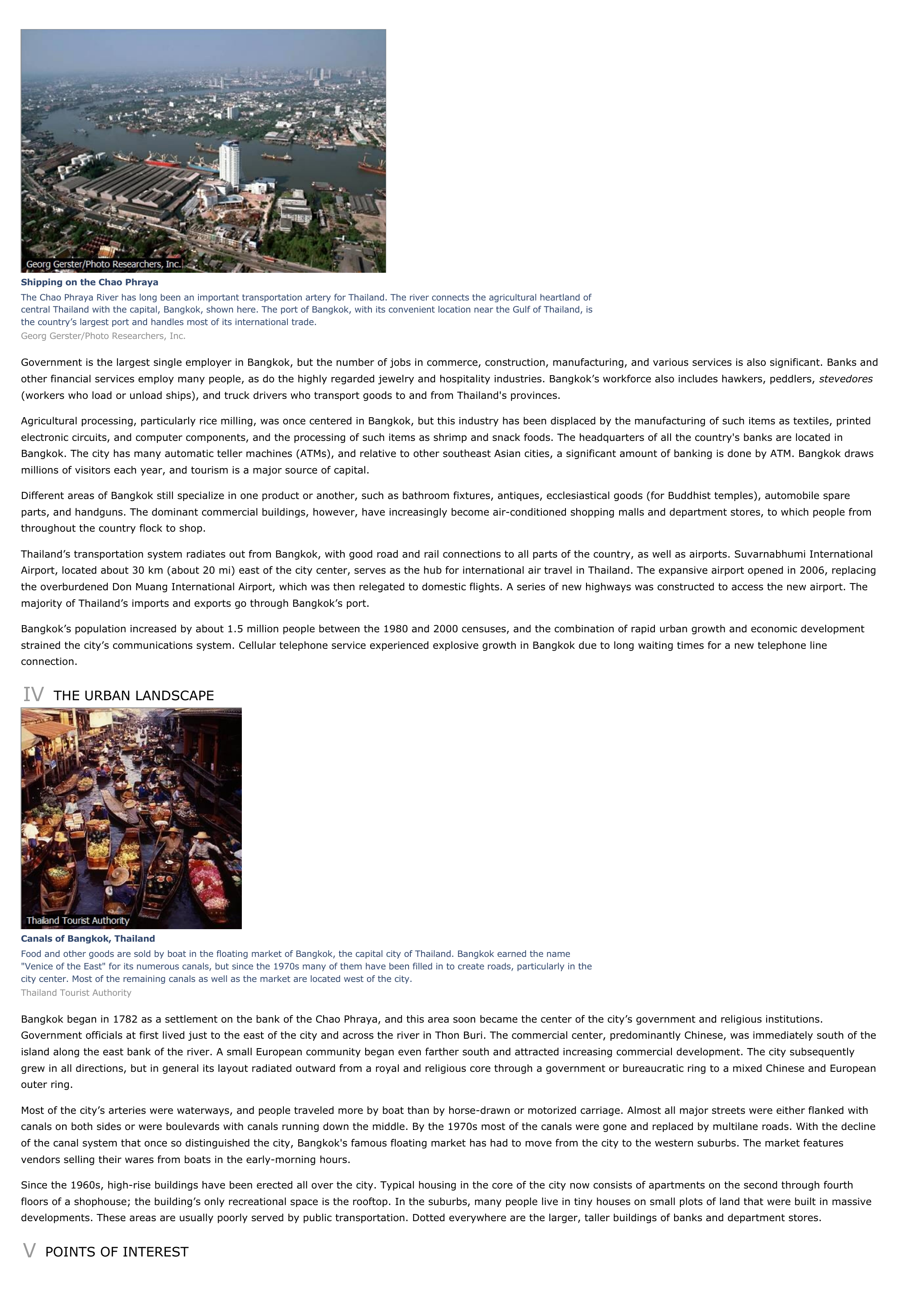
Shipping on the Chao PhrayaThe Chao Phraya River has long been an important transportation artery for Thailand.
The river connects the agricultural heartland ofcentral Thailand with the capital, Bangkok, shown here.
The port of Bangkok, with its convenient location near the Gulf of Thailand, isthe country’s largest port and handles most of its international trade.Georg Gerster/Photo Researchers, Inc.
Government is the largest single employer in Bangkok, but the number of jobs in commerce, construction, manufacturing, and various services is also significant.
Banks andother financial services employ many people, as do the highly regarded jewelry and hospitality industries.
Bangkok’s workforce also includes hawkers, peddlers, stevedores (workers who load or unload ships), and truck drivers who transport goods to and from Thailand's provinces.
Agricultural processing, particularly rice milling, was once centered in Bangkok, but this industry has been displaced by the manufacturing of such items as textiles, printedelectronic circuits, and computer components, and the processing of such items as shrimp and snack foods.
The headquarters of all the country's banks are located inBangkok.
The city has many automatic teller machines (ATMs), and relative to other southeast Asian cities, a significant amount of banking is done by ATM.
Bangkok drawsmillions of visitors each year, and tourism is a major source of capital.
Different areas of Bangkok still specialize in one product or another, such as bathroom fixtures, antiques, ecclesiastical goods (for Buddhist temples), automobile spareparts, and handguns.
The dominant commercial buildings, however, have increasingly become air-conditioned shopping malls and department stores, to which people fromthroughout the country flock to shop.
Thailand’s transportation system radiates out from Bangkok, with good road and rail connections to all parts of the country, as well as airports.
Suvarnabhumi InternationalAirport, located about 30 km (about 20 mi) east of the city center, serves as the hub for international air travel in Thailand.
The expansive airport opened in 2006, replacingthe overburdened Don Muang International Airport, which was then relegated to domestic flights.
A series of new highways was constructed to access the new airport.
Themajority of Thailand’s imports and exports go through Bangkok’s port.
Bangkok’s population increased by about 1.5 million people between the 1980 and 2000 censuses, and the combination of rapid urban growth and economic developmentstrained the city’s communications system.
Cellular telephone service experienced explosive growth in Bangkok due to long waiting times for a new telephone lineconnection.
IV THE URBAN LANDSCAPE
Canals of Bangkok, ThailandFood and other goods are sold by boat in the floating market of Bangkok, the capital city of Thailand.
Bangkok earned the name"Venice of the East" for its numerous canals, but since the 1970s many of them have been filled in to create roads, particularly in thecity center.
Most of the remaining canals as well as the market are located west of the city.Thailand Tourist Authority
Bangkok began in 1782 as a settlement on the bank of the Chao Phraya, and this area soon became the center of the city’s government and religious institutions.Government officials at first lived just to the east of the city and across the river in Thon Buri.
The commercial center, predominantly Chinese, was immediately south of theisland along the east bank of the river.
A small European community began even farther south and attracted increasing commercial development.
The city subsequentlygrew in all directions, but in general its layout radiated outward from a royal and religious core through a government or bureaucratic ring to a mixed Chinese and Europeanouter ring.
Most of the city’s arteries were waterways, and people traveled more by boat than by horse-drawn or motorized carriage.
Almost all major streets were either flanked withcanals on both sides or were boulevards with canals running down the middle.
By the 1970s most of the canals were gone and replaced by multilane roads.
With the declineof the canal system that once so distinguished the city, Bangkok's famous floating market has had to move from the city to the western suburbs.
The market featuresvendors selling their wares from boats in the early-morning hours.
Since the 1960s, high-rise buildings have been erected all over the city.
Typical housing in the core of the city now consists of apartments on the second through fourthfloors of a shophouse; the building’s only recreational space is the rooftop.
In the suburbs, many people live in tiny houses on small plots of land that were built in massivedevelopments.
These areas are usually poorly served by public transportation.
Dotted everywhere are the larger, taller buildings of banks and department stores.
V POINTS OF INTEREST.
»
↓↓↓ APERÇU DU DOCUMENT ↓↓↓
Liens utiles
- Bangkok - geography.
- Script:Bangkok vu du fleuve Chao Phra Ya
- Bangkok - geographie.
- Tokyo - geography.
- Toronto - geography.


