?stanbul - geography.
Publié le 27/05/2013

Extrait du document
«
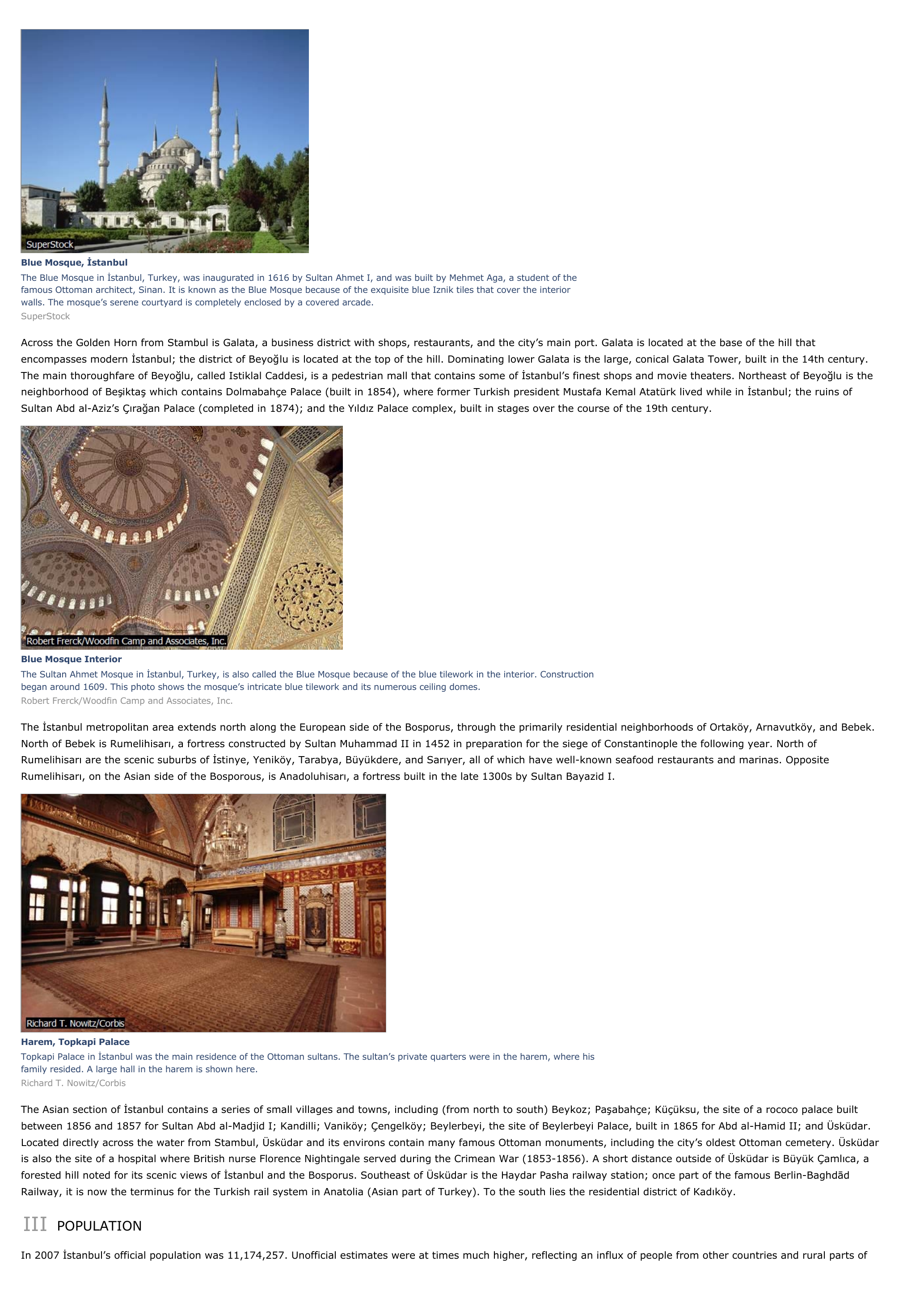
Blue Mosque, İstanbulThe Blue Mosque in İstanbul, Turkey, was inaugurated in 1616 by Sultan Ahmet I, and was built by Mehmet Aga, a student of thefamous Ottoman architect, Sinan.
It is known as the Blue Mosque because of the exquisite blue Iznik tiles that cover the interiorwalls.
The mosque’s serene courtyard is completely enclosed by a covered arcade.SuperStock
Across the Golden Horn from Stambul is Galata, a business district with shops, restaurants, and the city’s main port.
Galata is located at the base of the hill thatencompasses modern İstanbul; the district of Beyo ğlu is located at the top of the hill.
Dominating lower Galata is the large, conical Galata Tower, built in the 14th century.The main thoroughfare of Beyo ğlu, called Istiklal Caddesi, is a pedestrian mall that contains some of İstanbul’s finest shops and movie theaters.
Northeast of Beyo ğlu is theneighborhood of Be şikta ş which contains Dolmabahçe Palace (built in 1854), where former Turkish president Mustafa Kemal Atatürk lived while in İstanbul; the ruins ofSultan Abd al-Aziz’s Ç ıra ğan Palace (completed in 1874); and the Y ıld ız Palace complex, built in stages over the course of the 19th century.
Blue Mosque InteriorThe Sultan Ahmet Mosque in İstanbul, Turkey, is also called the Blue Mosque because of the blue tilework in the interior.
Constructionbegan around 1609.
This photo shows the mosque’s intricate blue tilework and its numerous ceiling domes.Robert Frerck/Woodfin Camp and Associates, Inc.
The İstanbul metropolitan area extends north along the European side of the Bosporus, through the primarily residential neighborhoods of Ortaköy, Arnavutköy, and Bebek.North of Bebek is Rumelihisar ı, a fortress constructed by Sultan Muhammad II in 1452 in preparation for the siege of Constantinople the following year.
North ofRumelihisar ı are the scenic suburbs of İstinye, Yeniköy, Tarabya, Büyükdere, and Sar ıyer, all of which have well-known seafood restaurants and marinas.
OppositeRumelihisar ı, on the Asian side of the Bosporous, is Anadoluhisar ı, a fortress built in the late 1300s by Sultan Bayazid I.
Harem, Topkapi PalaceTopkapi Palace in İstanbul was the main residence of the Ottoman sultans.
The sultan’s private quarters were in the harem, where hisfamily resided.
A large hall in the harem is shown here.Richard T.
Nowitz/Corbis
The Asian section of İstanbul contains a series of small villages and towns, including (from north to south) Beykoz; Pa şabahçe; Küçüksu, the site of a rococo palace builtbetween 1856 and 1857 for Sultan Abd al-Madjid I; Kandilli; Vaniköy; Çengelköy; Beylerbeyi, the site of Beylerbeyi Palace, built in 1865 for Abd al-Hamid II; and Üsküdar.Located directly across the water from Stambul, Üsküdar and its environs contain many famous Ottoman monuments, including the city’s oldest Ottoman cemetery.
Üsküdaris also the site of a hospital where British nurse Florence Nightingale served during the Crimean War (1853-1856).
A short distance outside of Üsküdar is Büyük Çaml ıca, aforested hill noted for its scenic views of İstanbul and the Bosporus.
Southeast of Üsküdar is the Haydar Pasha railway station; once part of the famous Berlin-Baghd ādRailway, it is now the terminus for the Turkish rail system in Anatolia (Asian part of Turkey).
To the south lies the residential district of Kad ıköy.
III POPULATION
In 2007 İstanbul’s official population was 11,174,257.
Unofficial estimates were at times much higher, reflecting an influx of people from other countries and rural parts of.
»
↓↓↓ APERÇU DU DOCUMENT ↓↓↓
Liens utiles
- ?stanbul - geography.
- Tokyo - geography.
- Toronto - geography.
- Venice (Italy) - geography.
- Vienna - geography.


