Yangtze - geography.
Publié le 26/05/2013

Extrait du document
«
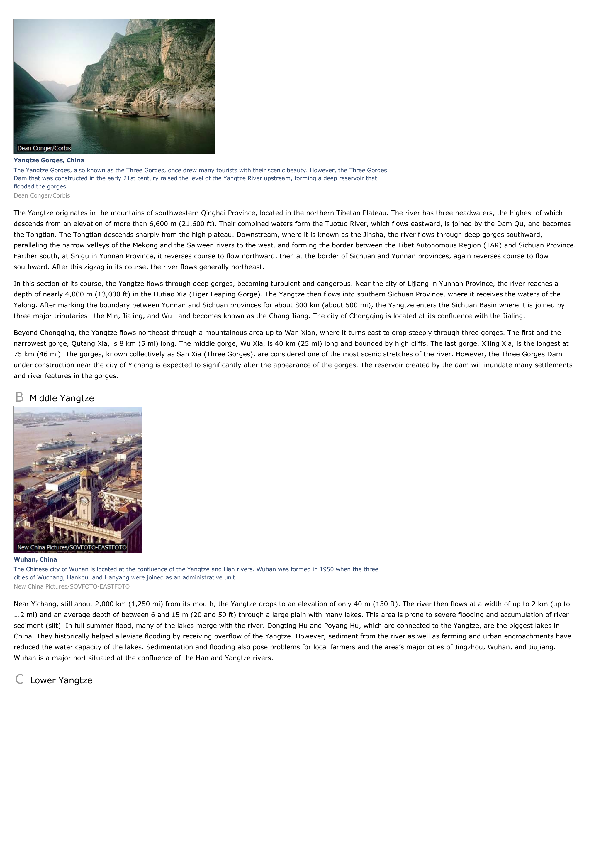
Yangtze Gorges, ChinaThe Yangtze Gorges, also known as the Three Gorges, once drew many tourists with their scenic beauty.
However, the Three GorgesDam that was constructed in the early 21st century raised the level of the Yangtze River upstream, forming a deep reservoir thatflooded the gorges.Dean Conger/Corbis
The Yangtze originates in the mountains of southwestern Qinghai Province, located in the northern Tibetan Plateau.
The river has three headwaters, the highest of whichdescends from an elevation of more than 6,600 m (21,600 ft).
Their combined waters form the Tuotuo River, which flows eastward, is joined by the Dam Qu, and becomesthe Tongtian.
The Tongtian descends sharply from the high plateau.
Downstream, where it is known as the Jinsha, the river flows through deep gorges southward,paralleling the narrow valleys of the Mekong and the Salween rivers to the west, and forming the border between the Tibet Autonomous Region (TAR) and Sichuan Province.Farther south, at Shigu in Yunnan Province, it reverses course to flow northward, then at the border of Sichuan and Yunnan provinces, again reverses course to flowsouthward.
After this zigzag in its course, the river flows generally northeast.
In this section of its course, the Yangtze flows through deep gorges, becoming turbulent and dangerous.
Near the city of Lijiang in Yunnan Province, the river reaches adepth of nearly 4,000 m (13,000 ft) in the Hutiao Xia (Tiger Leaping Gorge).
The Yangtze then flows into southern Sichuan Province, where it receives the waters of theYalong.
After marking the boundary between Yunnan and Sichuan provinces for about 800 km (about 500 mi), the Yangtze enters the Sichuan Basin where it is joined bythree major tributaries—the Min, Jialing, and Wu—and becomes known as the Chang Jiang.
The city of Chongqing is located at its confluence with the Jialing.
Beyond Chongqing, the Yangtze flows northeast through a mountainous area up to Wan Xian, where it turns east to drop steeply through three gorges.
The first and thenarrowest gorge, Qutang Xia, is 8 km (5 mi) long.
The middle gorge, Wu Xia, is 40 km (25 mi) long and bounded by high cliffs.
The last gorge, Xiling Xia, is the longest at75 km (46 mi).
The gorges, known collectively as San Xia (Three Gorges), are considered one of the most scenic stretches of the river.
However, the Three Gorges Damunder construction near the city of Yichang is expected to significantly alter the appearance of the gorges.
The reservoir created by the dam will inundate many settlementsand river features in the gorges.
B Middle Yangtze
Wuhan, ChinaThe Chinese city of Wuhan is located at the confluence of the Yangtze and Han rivers.
Wuhan was formed in 1950 when the threecities of Wuchang, Hankou, and Hanyang were joined as an administrative unit.New China Pictures/SOVFOTO-EASTFOTO
Near Yichang, still about 2,000 km (1,250 mi) from its mouth, the Yangtze drops to an elevation of only 40 m (130 ft).
The river then flows at a width of up to 2 km (up to1.2 mi) and an average depth of between 6 and 15 m (20 and 50 ft) through a large plain with many lakes.
This area is prone to severe flooding and accumulation of riversediment (silt).
In full summer flood, many of the lakes merge with the river.
Dongting Hu and Poyang Hu, which are connected to the Yangtze, are the biggest lakes inChina.
They historically helped alleviate flooding by receiving overflow of the Yangtze.
However, sediment from the river as well as farming and urban encroachments havereduced the water capacity of the lakes.
Sedimentation and flooding also pose problems for local farmers and the area’s major cities of Jingzhou, Wuhan, and Jiujiang.Wuhan is a major port situated at the confluence of the Han and Yangtze rivers.
C Lower Yangtze.
»
↓↓↓ APERÇU DU DOCUMENT ↓↓↓
Liens utiles
- Yangtze - Geography.
- Tokyo - geography.
- Toronto - geography.
- Venice (Italy) - geography.
- Vienna - geography.


