Sierra Madre (mountain range, Mexico) - geography.
Publié le 04/05/2013

Extrait du document

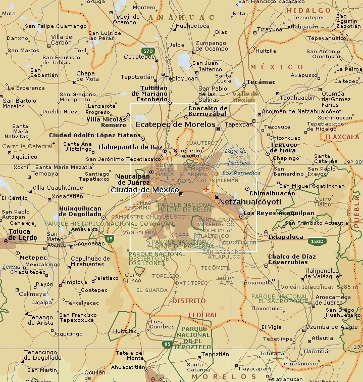
Sierra Madre (mountain range, Mexico) - geography. Sierra Madre (mountain range, Mexico), mountain system in Mexico. It is the southern extension of the great Cordillera system of North America. The Sierra Madre comprises three major chains: the Sierra Madre Occidental in the west, the Sierra Madre Oriental in the east, and the Sierra Madre del Sur, which extends along the southern coast. The Trans-Mexican Volcanic Belt, located south of Mexico City, is often included with the Sierra Madre. Vegetation in the Sierra Madre varies with temperature and moisture. The climate is mostly temperate, so highland vegetation consists mostly of oak and pine forest. On some windward slopes above the pine zone (about 1980 m/6500 ft), cloud forests contain giant broad-leaved evergreens. As moisture increases toward the south, lowland vegetation ranges from northern desert species to southern tropical species. The Sierra Madre Occidental stretch south-southeast from the United States border, extending more than 1100 km (700 mi) along the western coast of Mexico toward Guadalajara. Mountains as high as 3500 m (about 11,500 ft) form the western margin of the arid central Mexican Plateau. They are arranged in a broad, high escarpment deeply incised by west-flowing rivers such as the Río Fuerte and Río Grande de Santiago. These deep canyons, known as barrancas, can exceed 1000 m (3300 ft) in depth and rival the Grand Canyon in magnitude. Along its western margin, the range is separated from the Gulf of California by a broad coastal plain that widens to the Sonoran Desert in the northwest. This range contains the famed silver mines of the Spanish conquistadors, which are said to have produced the richest yields of silver ever known. These mines were lost for more than 200 years, resulting in lore depicted by books and motion pictures, most notably The Treasure of Sierra Madre (1948). The city of Chihuahua is on the northeastern margin of the range in the central Mexican Plateau. Mazatlán is on the coastal flank and Durango is on the eastern margin of the central range. The Sierra Madre Oriental system stretches southeast in parallel ridges from the Big Bend area of the Río Grande to Monterrey. From Monterrey, it bends south to near Puebla and joins the Trans-Mexican Volcanic Belt. The range is bounded on the west by the central Mexican Plateau and on the east by the Gulf of Mexico coastal plain. Northwest of Monterrey, the range is low and indistinct, with few peaks reaching 2700 m (8850 ft). To the south it is higher, with peaks such Cerro Peña Nevada (3,660 m/12,008 ft). Several large rivers flow east through the range, including the Río Moctezuma, which drains the central Mesa and flows to the Gulf of Mexico. Many of the rocks in this range are carbonates, and there are numerous deep caves and sinkholes. Copper, lead, and zinc deposits are found here. The Sierra Madre del Sur stretches from the southern end of the Sierra Madre Occidental range east to the Isthmus of Tehuantepec. Mountains in the chain reach an elevation of about 3850 m (about 12,630 ft). Deposits of gold, silver, iron ore, and lead are found here. Acapulco is located on the coast at the base of the central mountain, and Oaxaca de Juárez is in the southwestern part of the range. The Trans-Mexican Volcanic Belt (also known as the Cordillera de Anáhuac) is an irregular young volcanic plateau more than 2000 m (more than 6560 ft) high, connecting the Sierra Madre Occidental and Oriental ranges south of Mexico City. Located in the range are Pico de Orizaba (Citlaltépetl) (5,610 m/18,406 ft), Popocatépetl (5452 m/17,887 ft), and Iztaccíhuatl (5286 m/17,343 ft), the highest mountains in Mexico. Paricutín, a relatively young mountain, is also here. Contributed By: L. Allan James Microsoft ® Encarta ® 2009. © 1993-2008 Microsoft Corporation. All rights reserved.
Liens utiles
- Sierra Madre (mountain range, Mexico) - geography.
- Olympus Greek A mountain range in northern Greece.
- Mexico City - geography.
- New Mexico - geography.
- Mountain - geography.


