Ganges - geography.
Publié le 26/05/2013

Extrait du document
«
sugarcane, and jute are cultivated.
Only a stretch of the southwestern delta, covered with mangrove trees, is left uncultivated.
The mangroves are ideal habitat for severalspecies of crocodile.
Because the Ganges is fed by snow-capped peaks, it remains a sizable body of water throughout the year and can be used for extensive irrigation even during the hot, dryseason of April through June.
During the summer monsoon season, heavy rains can cause destructive floods, especially in the delta area.
IV RELIGIOUS IMPORTANCE
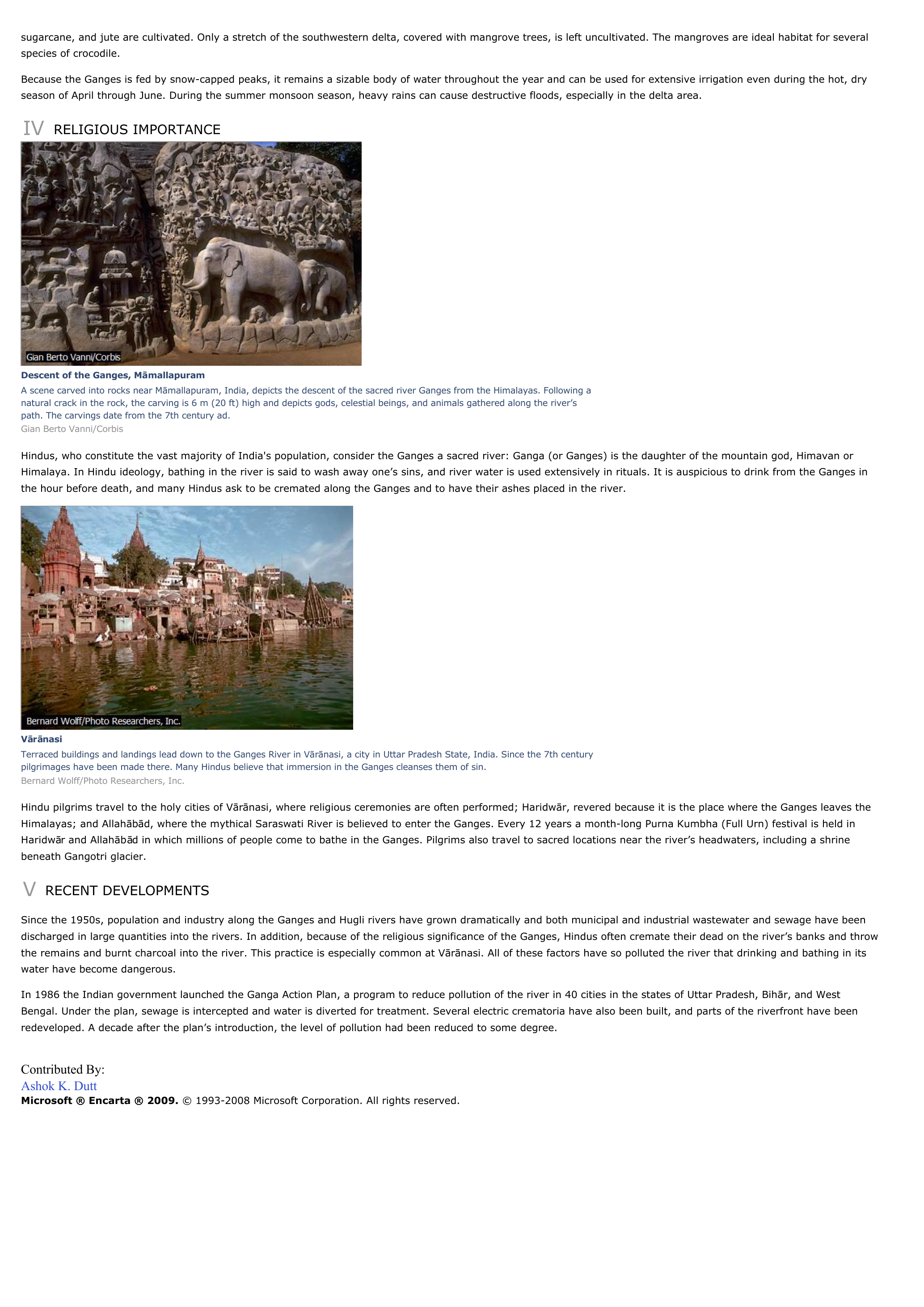
Descent of the Ganges, MāmallapuramA scene carved into rocks near M āmallapuram, India, depicts the descent of the sacred river Ganges from the Himalayas.
Following anatural crack in the rock, the carving is 6 m (20 ft) high and depicts gods, celestial beings, and animals gathered along the river’spath.
The carvings date from the 7th century ad.Gian Berto Vanni/Corbis
Hindus, who constitute the vast majority of India's population, consider the Ganges a sacred river: Ganga (or Ganges) is the daughter of the mountain god, Himavan orHimalaya.
In Hindu ideology, bathing in the river is said to wash away one’s sins, and river water is used extensively in rituals.
It is auspicious to drink from the Ganges inthe hour before death, and many Hindus ask to be cremated along the Ganges and to have their ashes placed in the river.
V ārā nasiTerraced buildings and landings lead down to the Ganges River in V ārā nasi, a city in Uttar Pradesh State, India.
Since the 7th centurypilgrimages have been made there.
Many Hindus believe that immersion in the Ganges cleanses them of sin.Bernard Wolff/Photo Researchers, Inc.
Hindu pilgrims travel to the holy cities of V ārā nasi, where religious ceremonies are often performed; Haridw ār, revered because it is the place where the Ganges leaves theHimalayas; and Allah ābād, where the mythical Saraswati River is believed to enter the Ganges.
Every 12 years a month-long Purna Kumbha (Full Urn) festival is held inHaridw ār and Allah āb ād in which millions of people come to bathe in the Ganges.
Pilgrims also travel to sacred locations near the river’s headwaters, including a shrinebeneath Gangotri glacier.
V RECENT DEVELOPMENTS
Since the 1950s, population and industry along the Ganges and Hugli rivers have grown dramatically and both municipal and industrial wastewater and sewage have beendischarged in large quantities into the rivers.
In addition, because of the religious significance of the Ganges, Hindus often cremate their dead on the river’s banks and throwthe remains and burnt charcoal into the river.
This practice is especially common at V ārā nasi.
All of these factors have so polluted the river that drinking and bathing in itswater have become dangerous.
In 1986 the Indian government launched the Ganga Action Plan, a program to reduce pollution of the river in 40 cities in the states of Uttar Pradesh, Bih ār, and WestBengal.
Under the plan, sewage is intercepted and water is diverted for treatment.
Several electric crematoria have also been built, and parts of the riverfront have beenredeveloped.
A decade after the plan’s introduction, the level of pollution had been reduced to some degree.
Contributed By:Ashok K.
DuttMicrosoft ® Encarta ® 2009. © 1993-2008 Microsoft Corporation.
All rights reserved..
»
↓↓↓ APERÇU DU DOCUMENT ↓↓↓
Liens utiles
- Ganges - Geography.
- Ganges - geographie.
- Tokyo - geography.
- Toronto - geography.
- Venice (Italy) - geography.


